Ski Lift Safety Bar Maps
|
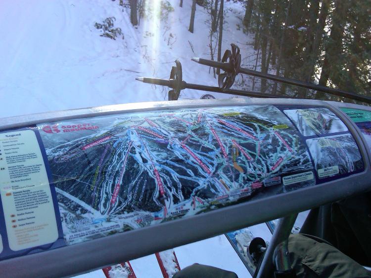
I have seen that a couple mountains out west have installed trail maps on the ski lift safety bars. This is a picture of one at Copper Mountain.
 I don't think that anyone in the east has installed them yet. I think that it would be great for Gore to be the first to install safety bar maps starting with the AE2 and BRQ. I think that they would be especially useful as Gore is a large mountain with lots of different areas, and it can be hard to navigate at times. I think that the two HSQ's should get them first as they look better on newer lifts and since they are quad chairs, there would be more room to install them. I would say that they should add features to them saying what lift you are on. That would really help people plan their runs out and mean less trail crowding at the top and less paper maps dropped from the lift. After the AE2 and BRQ, I would add them to the Topridge, Straightbrook, and North lifts. If the Ski Bowl lift were open more, I would add them there too since it can be hard to find the way down there and back. The only lifts where I would not want to see them are the High Peaks Chair and Sunway Chair. These are doubles and probably wouldn't have enough room. They also are not good in areas with an old school feel like the Dark Side and look terrible on older lifts. They would be a silly waste of time and money on the Sunway Chair because the people who ride that lift usually are not trying to navigate the whole mountain. Does anyone else think that it would be a good idea to add safety bar maps to the Gore lifts.
I've lived in New York my entire life.
|
|
Instead of spending money on that, they should widen the slots in the gondola to fit bigger skis.
|
|
Do I need to say it again - Waffle Hut!
Don't ski the trees, ski the spaces between the trees.
|
|
I know of another multi-peaked area that may be in need of these things to help get skiers around:
 In all seriousness, I've seen these at resorts and they usually look like crap after two years, the resorts never put new maps in them, and then they get chucked in the trash. Those resorts had to have been in the east. I vaguely remember Sugarbush having them at one point on the Slide Brook. |
|
I've seen these at a few bigger resorts in the east. But I don't recall seeing any recently. I suspect they were taken out when the resort realized how much maintenance would be involved with fixing the maps and replacing them when their trail map changes. Maybe one or two are still out there at resorts that I only skied once and done.
I'd rather ski areas not add expenses like this (that get passed on in ticket prices) when they already offer paper trail maps and large posted maps at the top of the lifts. I've never felt that maps at the top/bottom of lifts create congestion. That type of congestion is more caused by a specific type of skier at a specific type of mountain.
-Steve
www.thesnowway.com
|
|
Administrator
|
Problem is the the BRQ and the AE2 are too fast, not enough time to study the map.
I'd be in favor of it if they slow those lifts down to the speed of the North Chair, maybe 400 fpm.
"You just need to go at that shit wide open, hang on, and own it." —Camp
|
|
In reply to this post by PeeTex
+1 !
|
|
Pretty sure Straightbrook used to have them.
|
I was just going to post this. I think you are right. |
|
yes they had them. very annoying, limited leg clearance ,covered in rime, always dripping ,hard to bring bar down.
Tele turns are optional not mandatory.
|
|
In reply to this post by ml242
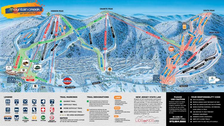
That map has more snow than ever has been on the hill at Mountain Creek  The reason they don't use these in the east is that when you make snow under the lift it just doesn't work as they become ice magnets.
if You French Fry when you should Pizza you are going to have a bad time
|
But if we make all lifts bubble lifts.... |
|
This post was updated on .
In reply to this post by Z
CONTENTS DELETED
The author has deleted this message.
I've lived in New York my entire life.
|

Tele turns are optional not mandatory.
|
|
Made me laugh
if You French Fry when you should Pizza you are going to have a bad time
|
Re: Ski Lift Safety Bar Maps
|
Who needs maps anyways? Get out there explore don't go past the boundary signs and you'll be fine.
|
|
In reply to this post by riverc0il
Same here, I've seen it at a few places maybe 10 years. I don't recall where, except that it was in the East. If It was a smart and practical idea it would have remained. That being said, I know a few places that have ads on the safety bar now instead.
Ski Mad World
A blog of MadPat's World: A History of Skiing Geography |
|
Banned User
|
In reply to this post by MC2 5678F589
X10. The maps on Straightbrook sucked. They were mounted on a round thing. First few times I road it and I sat under one when the bar came down, it clamped down hard on my leg. It usually went something like this..... Ow ! Ow ! Ow ! Everybody get your feet off the bar ! What ? Ow ! Ow ! Ow ! Feet off the bar ! What ? Get your feet off the bar dumb ass ! OH ! |
|
I like the safety bar maps. I'm terrible with names of trails so it's a good tool to learn the mountain, I think they had them in Breck on a few of the cushy lifts. I'm an ogre and have a large head, so safety bar map or not, I'm ducking when the bar goes down
The day begins... Your mountain awaits.
|
«
Return to Woodstove Archive
|
1 view|%1 views

