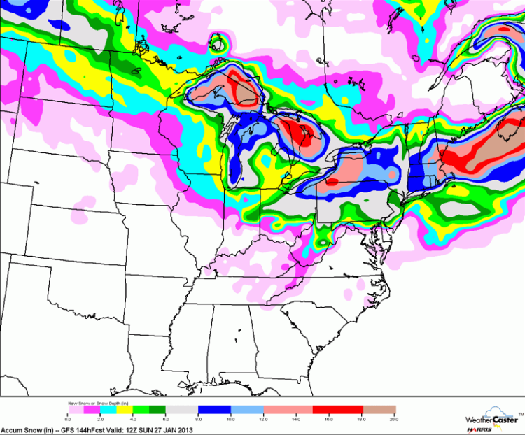
Storm Speculation: 1/25/13

Storm Speculation: 1/25/13

Administrator
|
Re: Storm Speculation: 1/25/13
|
|
Re: Storm Speculation: 1/25/13
|
|
Re: Storm Speculation: 1/25/13
|
Administrator
|
Re: Storm Speculation: 1/25/13
|
|
Re: Storm Speculation: 1/25/13
|
|
Re: Storm Speculation: 1/25/13
|
|
Re: Storm Speculation: 1/25/13
|
|
Re: Storm Speculation: 1/25/13
|
|
Re: Storm Speculation: 1/25/13
|
|
Re: Storm Speculation: 1/25/13
|
|
Re: Storm Speculation: 1/25/13
|
|
Re: Storm Speculation: 1/25/13
|
|
Re: Storm Speculation: 1/25/13
|
|
Re: Storm Speculation: 1/25/13
|
|
Re: Storm Speculation: 1/25/13
|
|
Re: Storm Speculation: 1/25/13
|
|

Re: Storm Speculation: 1/25/13
|
Administrator
|
Re: Storm Speculation: 1/25/13
|
|