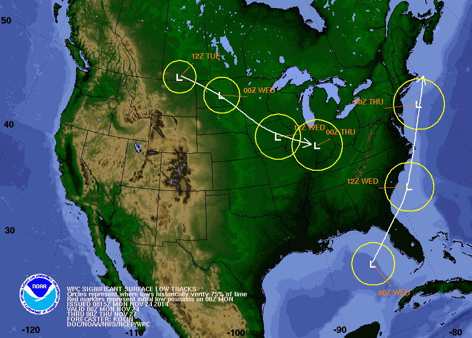
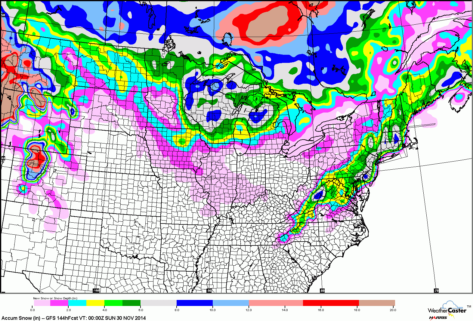
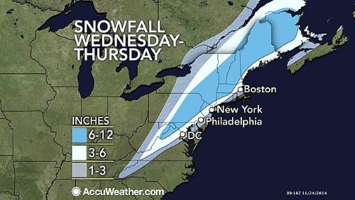
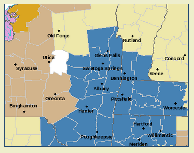
Storm Speculation: 11/27/14

12

12
Storm Speculation: 11/27/14

Administrator
|
Re: Storm Speculation: 11/27/14
|
Administrator
|
Re: Storm Speculation: 11/27/14
|
Administrator
|
Re: Storm Speculation: 11/27/14
|
Banned User
|
Re: Storm Speculation: 11/27/14
|
Administrator
|
Re: Storm Speculation: 11/27/14
|
Administrator
|
Re: Storm Speculation: 11/27/14
|
Administrator
|
Re: Storm Speculation: 11/27/14
|
Administrator
|
Re: Storm Speculation: 11/27/14
|
|
Re: Storm Speculation: 11/27/14
|
Administrator
|
Re: Storm Speculation: 11/27/14
|
Administrator
|
Re: Storm Speculation: 11/27/14
|
|
Re: Storm Speculation: 11/27/14
|
|
Re: Storm Speculation: 11/27/14
|
Administrator
|
Re: Storm Speculation: 11/27/14
|
|
Re: Storm Speculation: 11/27/14
|
Banned User
|
Re: Storm Speculation: 11/27/14
|
|
Re: Storm Speculation: 11/27/14
|
Administrator
|
Re: Storm Speculation: 11/27/14
|
|
Re: Storm Speculation: 11/27/14
|
Administrator
|