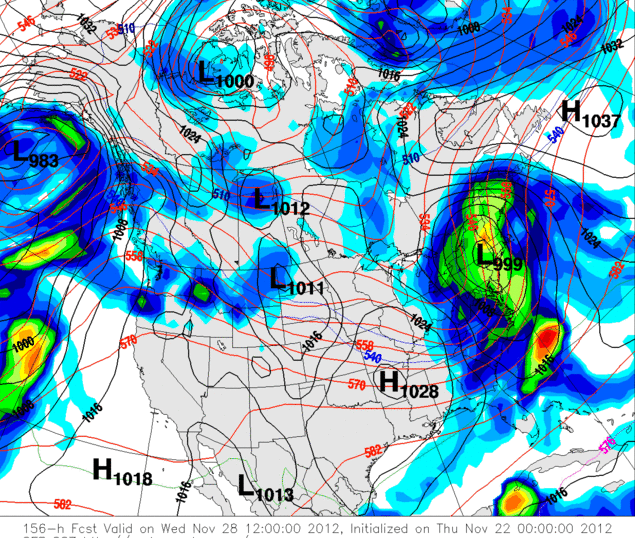
Was playing around on the Weather Page and it looks like the GFS has something for next Weds...

Also looks like there is zero model consensus, and it could be a warm event... but you got to be in it to win it.
NWS Albany Long Term:
A sfc wave would eject out of the lower and cntrl ms river Valley...And head into the ohio valley...And great lakes region by Nightfall. Most of fcst area would be on the warm side of the system with mostly rain...Except for some snow on the onset...And for the nrn zones.
The ecmwf is drastically different with a complete miss...As the srn stream sfc wave stays south tue-tue night with the mid level trough amplifying too much.
The hpc guidance looks closer to the gefs ensemble mean...With a cold front hanging Just west of the region with a sfc low moving northeast from the tn Valley on tuesday. Thermal profiles would indicate a predominate rain ptype tue...From the capital region south...And then a transition to snow tue night into wed with the wave redeveloping near srn new england...As the primary wave falls apart over the ern Great Lakes region.
"You just need to go at that shit wide open, hang on, and own it." —Camp