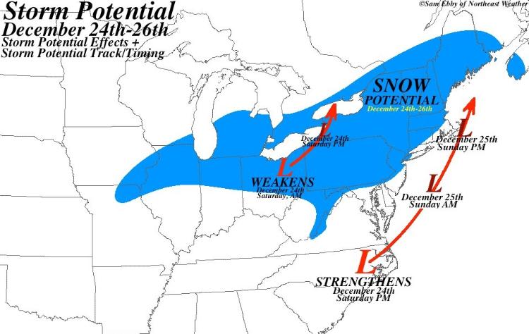
I like Matt's guess. Something measurable plus a few extra inches for stoke.
Found this on Weather.com:
There are two possible scenarios for Christmas weekend in the Northeast. The first scenario: Two areas of low pressure, one in southern Canada, the other off the East Coast bring accumulating snow to parts of the Great Lakes and Interior Northeast. In this case, cold high pressure would retreat enough to keep the I-95 Boston-Washington corridor predominantly rain.
The other scenario is more interesting for the I-95 corridor. This track features only one surface low...tracking just off the Northeast seaboard, potentially keeping just enough cold air in place for accumulating snow from Philadelphia, New York City, Hartford, and Boston. With that said, a period of rain could occur in these locations as the low slides by.
"You just need to go at that shit wide open, hang on, and own it." —Camp