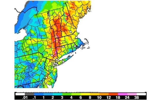
From my girl on FB ---- does this help anyone who understands what she's saying??? All I gather is that it's gonna snow.
Rebecca's Northeast weather and education page
The latest HRRR model run
The dry slot part of the storm has ended snows in southern New England and in the Mid Hudson Valley southward. You can see this by looking at the radar image. Don't be fooled into thinking that the storm is over. We will be just seeing a break in the action, waiting for act two. later tonight as the storm really starts to crank up, PA, NYS and New England will be on the western and north-western side of the storm. By tonight, we will enter that cold conveyor belt part of the storm, that I told you about the other day. This part of the storm is when we see the deformation zone setup and cause mesoscale banding. if the models are right, a mega band will set up across part of eastern NYS into the Capital District and into MA and VT. other bands look to setup across Southeast PA and into NJ.
areas of southeast PA like Philly especially the N & W burbs, Lehigh Valley, into Central and Northern NJ , NYC . will pick up 2-5 inches of snow.
Those further inland would pick up several more inches
