We're sending you some weather...

classic Classic list List threaded Threaded
7 messages Options
Reply | Threaded
Open this post in threaded view
|

We're sending you some weather...

Sick Bird Rider
This just in from Environment Canada (bold put in by me). For the geographically challenged, check our 
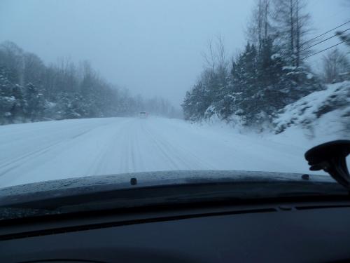
local weather radar and you will see Huntsville just right of centre in the image (geographically and politically, I'm sad to say) :

Huntsville - Baysville
5:05 AM EST Saturday 11 December 2010
Winter storm watch for
Huntsville - Baysville issued

..Significant amounts of snow and blowing snow possible beginning Sunday..

This is an alert to the potential development of dangerous winter weather conditions in these regions. Monitor weather conditions..Listen for updated statements.

A low pressure system centred over Iowa is tracking east towards the lower Great Lakes and may intensify into a winter storm as it reaches Western New York state by Sunday night.

An expanding area of snow is expected to move into Southern Ontario first thing Sunday morning as the low gets closer and deepens. As a result the snow may become heavy at times..With amounts of 15 to 20 cm quite possible by Sunday night.

The snow may mix briefly with rain over southern parts of the watch area extending from Stratford across Kitchener-Waterloo to Newmarket and Peterborough. There is also a possibility of ice pellets and freezing rain especially in the Ottawa Valley. However the precipitation should change to all snow by Sunday night as much colder Arctic air begins to blast in from the north causing the mercury to plummet.

Strong northerly winds developing Sunday night in the wake of the storm centre will also result in local blowing snow especially over western and northern sections.

Travelling conditions are expected to quickly deteriorate Sunday as the snow moves in. Hazardous winter driving conditions are likely due to low visibility in heavy snow..Blowing snow..And from accumulating snow.

There is still some uncertainty as to the exact track of this deepening low pressure centre..Which would influence the location of the heaviest snow.

Environment Canada continues to closely monitor this threatening winter storm and will issue warnings and/or adjust this watch as necessary.
Love Jay Peak? Hate Jay Peak? You might enjoy this: The Real Jay Peak Snow Report
Reply | Threaded
Open this post in threaded view
|

Re: We're sending you some weather...

sudsnbumps
SBR you are on the cold side of the storm unfortunately Gore is not.  Just got in from the mountain today and all I can say is we need some colder air or we are in trouble.  Nice conditions today but if we get heavy rain it is going to hurt the progress of the snowmakers.  Think Snow we need all the positive vibes we can get
Proud to call Gore My Home Mountain
Covid stole what would have been my longest season ever!
I'll be back
Reply | Threaded
Open this post in threaded view
|

Re: We're sending you some weather...

JasonWx
sud's, you seem to have some weather knowledge..Have you seen the 18z fous for ALB and BTV...Scary warm
"Peace and Love"
Reply | Threaded
Open this post in threaded view
|

Re: We're sending you some weather...

sudsnbumps
started college for it way back when...It was eerie warm at Gore today...a semi warm breeze,it didn't feel right but it did seem to get colder as the day went on
I just went to Unisys to check all the models they have  the Nam and AVN are trying to form a low off the coast...maybe there is still some hope...however NWS says the coastal low gets gobbled by the inland one, I hope they're wrong...I haven't given up on a ski day monday...Where is that Boler Mt?
We're skiers...aren't we all into the weather...some just get a little more excited about it...I have a scenario that could work...precip startls late tonight and piles up to 6 or so inches at Gore before change over and a brief period of ice pellets...the snow acts as a sponge and absorbs the rain...then the cold air locks the perfect base...snow on the back end and we have a powder day on Monday...just a really windy day though!
Proud to call Gore My Home Mountain
Covid stole what would have been my longest season ever!
I'll be back
Reply | Threaded
Open this post in threaded view
|

Re: We're sending you some weather...

Sick Bird Rider
In reply to this post by sudsnbumps
sudsnbumps wrote
SBR you are on the cold side of the storm
And that is a good thing.

Currently nuking snow in my neck of the woods.

This from a few hours ago on my drive to work, along a busy two-lane highway:

Love Jay Peak? Hate Jay Peak? You might enjoy this: The Real Jay Peak Snow Report
Reply | Threaded
Open this post in threaded view
|

Re: We're sending you some weather...

sudsnbumps
Proud to call Gore My Home Mountain
Covid stole what would have been my longest season ever!
I'll be back
Reply | Threaded
Open this post in threaded view
|

Re: We're sending you some weather...

JasonWx
Update 12/13
After yesterdays tropical monsoon , we are in for a few snowy and cold days. The LES snow machine should be in full force for the next couple of days along with significant upslope snows. The usual areas along the spin of of Greens should get at least a foot or better. The northern Dacks should do ok too. Snow should tapper off on wed and the weather should remain dry and seasonable through the weekend. The potential exists for a nice size storm Monday. But thats  way in the future. More on that as things develop.
"Peace and Love"