ausable skier wrote
so accuweather is forecasting a low of 23 in wilmington wed night and NWS is forecasting 11
this is a huge difference how can they explain it?
If I can't get something mountain specific (like Lionel from FIS) I use NWS point forecasts. They have two advantages in my mind.
First, I think (Jason?) they use a BLEND of models, so error is lower.
Second NWS has a point forecast system that accounts (to some degree) for elevation. If you are using the NWS whiteface link on the Harvey Road homepage, that is an estimate for temps at 3800 feet.
In each of our homepage links, I've tried to pinpoint the summit of mountain listed. While you will never get the full summit elevation you get a better approximation for what it happening at the mountain. Accuweather is guessing at what you get in town.
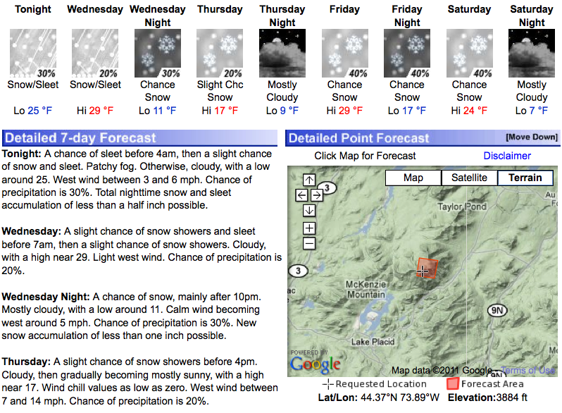
Here is the current NWS forecast for WHITEFACE (looks pretty good to me!)
Note in the lower right the elevation is noted as 3884:

ALSO NWS Burlington has a very cool feature that I haven't seen from Albany or any other NWS office. It's called the "Higher Summits Forecast." Burlington covers Whiteface. It gives an idea of what weather is like up top:
http://www.nws.noaa.gov/data/BTV/RECBTV.20111204202619
"You just need to go at that shit wide open, hang on, and own it." —Camp