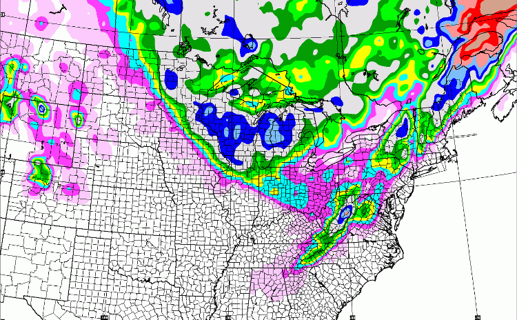
NWS ALB:The 12z models and guidance are in close agreement of a trough pattern developing over the eastern half of the united states along with a series of low pressure impulses impacting our region.
Model trends differ in strength of these impulses...Where some guidance shows limited moisture sources as they move east from the great lakes. Other guidance shows the apex of the 500 hpa trough reaching the delmarva where low pressure systems will tap into atlantic moisture with a coastal low developing and may produce moderate qpf to affect our region as we go into the coming weekend.
Thursday into friday night...A coastal low pressure system at the southern end of a front in the atlantic ocean will move north near the new england coastline. The track as of the latest model runs is northeastward into the north atlantic far away from The northeastern states which will allow tranquil conditions into the region.
...12z models show the upper level jet shifting to the new england coastline shifting winds in our region from a southerly to a more northwesterly flow which will allow temperatures to be at or slightly below normal from friday night to the end of the extended period.
Saturday into monday...Models are different in track and intensity of forecasted low pressure systems. Some of the latest guidance shows a surface low from a deepening upper level trough in the delmarva peninsula tracking northeast over long island providing the
chance of a significant snowfall event saturday into saturday evening while other models develop a surface low on a more negative tilted upper level trough well east into the atlantic and keeps the low pressure system far enough out to sea to not affect our area.
Some models depict another low pressure system moving southeast during the day on monday with some precipitation possible.

"You just need to go at that shit wide open, hang on, and own it." —Camp