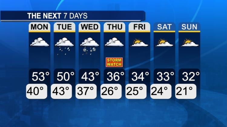
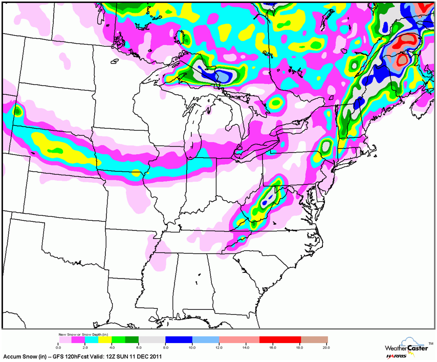
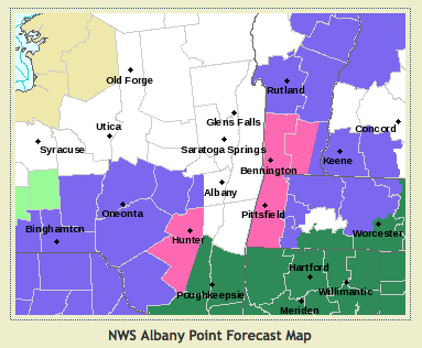
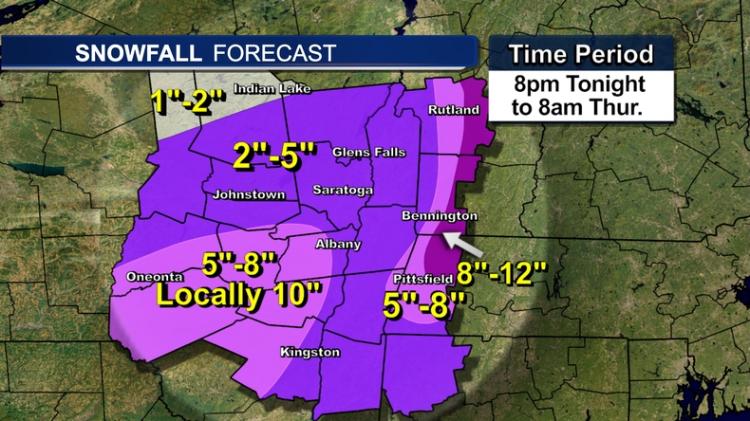
Storm Watch: Thursday 12/8

12

12
Storm Watch: Thursday 12/8

|
Re: Storm Watch: Thursday 12/8
|
|
Re: Storm Watch: 12/8/11
|
Administrator
|
Re: Storm Watch: 12/7/11
|
|
Re: Storm Watch: 12/7/11
|
|
Re: Storm Watch: 12/7/11
|
|
Re: Storm Watch: 12/7/11
|
Administrator
|
Re: Storm Watch: 12/7/11
|
Administrator
|
Re: Storm Watch: 12/7/11
|
|
Re: Storm Watch: 12/7/11
|
|
Re: Storm Watch: 12/8/11
|
Administrator
|
Re: Storm Watch: 12/8/11
|
|
Re: Storm Watch: 12/8/11
|
|
Re: Storm Watch: 12/8/11
|
|
Re: Storm Watch: 12/8/11
|
|
Re: Storm Watch: 12/8/11
|
|
Re: Storm Watch: 12/8/11
|
|
Re: Storm Watch: 12/8/11
|
Administrator
|
Re: Storm Watch: 12/8/11
|
|
Re: Storm Watch: 12/8/11
|
|