Winter Weather 2017-2018
1234
... 22
1234
... 22
|
Administrator
|
This post was updated on .
Some hope for Christmas Week?
NWS ALY LONG TERM ... Models seem to be keying in on the best chances for precipitation on Christmas Day (Monday). However, the exact track of a surface low and associated thermal profiles remain highly uncertain. It should be noted that the 00Z/19 ECMWF has trended farther south/east and slightly colder overall with this potential system, with the 00Z/19 GFS/GEFs and GEM remaining colder similar to previous cycles. Looks like snow or a wintry mix across at least a portion of the region assuming these trends continue, including some freezing rain. There remains a high degree of uncertainty for this possible storm system, and future forecasts will likely change as we approach, so tough to focus on the specifics this far out. However, the main message at this point is that situational awareness should be increased that an extended period of wintry precipitation could occur sometime between late Sunday through Christmas Day across at least a portion of eastern NY/western New England.
"You just need to go at that shit wide open, hang on, and own it." —Camp
|
|
the models are flirting with a weakish coastal wave...followed by some very cold weather.. I would bet on a white christmas day..
As of now I don't think we will have a major rain event , but it will rain to the boarder..
"Peace and Love"
|
|
looks like snow to mix to rain on Saturday followed by a break and maybe some snow on Xmas day, the trend is slightly better than what it looked like past few days. The snowpack will take a hit but trending away from a disaster.
|
agree..then we get into the Blahs..
"Peace and Love"
|
|
Jason, I just hope when we do get into the warm sector on Saturday its brief and not a half inch of rain....makes a huge difference for xmas week....
|
|
Administrator
|
 Looks like love all around... At least this is somewhat irrefutable...  
"You just need to go at that shit wide open, hang on, and own it." —Camp
|
|
We melt the snow we receive on Friday by Saturday morning (warmth, rain and slush)...hopefully we can get a refresher xmas day but the jury is still out. Think its cold by then just a matter of getting the storm close enough. After Xmas its cold to very cold.
|
|
Administrator
|
This is a point forecast the summit of Gore, but still it looking better...
Thursday Night: A chance of snow, mainly after 10pm. Mostly cloudy, with a low around 10. Northwest wind 5 to 9 mph becoming south after midnight. Chance of precipitation is 50%. Friday: Snow likely. Cloudy, with a high near 27. Chance of precipitation is 70%. Friday Night Snow likely, mainly after 4am. Cloudy, with a low around 22. Chance of precipitation is 70%. Saturday: Rain showers, snow showers, and sleet likely before 10am, then rain showers likely between 10am and 4pm, then rain and snow showers likely after 4pm. Cloudy, with a high near 39. Chance of precipitation is 70%. Saturday Night: Snow showers likely, mainly before 7pm. Mostly cloudy, with a low around 24. Chance of precipitation is 60%. Sunday: A chance of snow showers before 1pm. Mostly cloudy, with a high near 27. Chance of precipitation is 30%. Sunday Night: Snow likely. Cloudy, with a low around 18. Chance of precipitation is 60%. Christmas Day: Snow likely. Cloudy, with a high near 26. Chance of precipitation is 60%. Monday Night: A chance of snow showers. Mostly cloudy, with a low around 10. Chance of precipitation is 30%. Tuesday A chance of snow showers. Mostly cloudy, with a high near 15. Chance of precipitation is 40%.:
"You just need to go at that shit wide open, hang on, and own it." —Camp
|
|
SUCKS BALLS SO FAR!!
|
|
quick update
the euro went off in the 120hr..major coastal low the gfs nada...this should be interesting
"Peace and Love"
|
|
FRIDAY, 4-6 inches? Changing to a mix to freezing rain and rain Friday night....how much rain still remains to be seen...more snow Sunday into Xmas?
|
|
Administrator
|

"You just need to go at that shit wide open, hang on, and own it." —Camp
|
|
Administrator
|
Friday looks like the day.

"You just need to go at that shit wide open, hang on, and own it." —Camp
|
|
i think those are good numbers, problem is that there will be a pretty good dose of rain too..
"Peace and Love"
|
|
rain or freezing rain especially for the sheltered valleys...
|
|
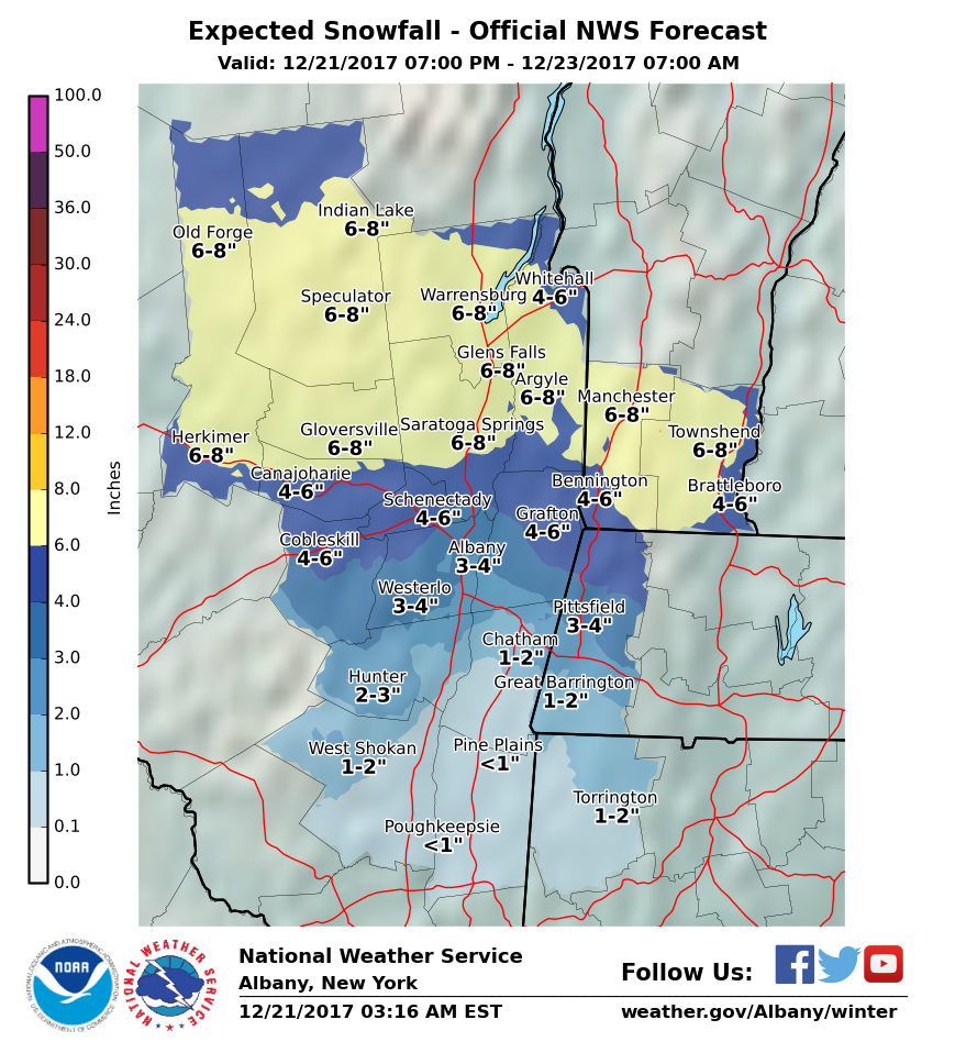
4-6 inches tomorrow, slight chance up to 8 inches in the higher elevations, goes over to a mix and rain on Saturday but the warmth only lasts for a few hrs and temps should mostly stay in the 30s. Shouldn't be a huge hit to the pack.
|
|
Administrator
|
That sounds snow pack positive to me?
"You just need to go at that shit wide open, hang on, and own it." —Camp
|
|
If you wanna stay positive read this:
http://madriverglenweather.blogspot.com/2017/12/steady-snow-friday-no-thaw-saturday-and.html
Skiing is not a sport, it is a way of life.
|
|
It looks to be a very active and interesting 10-14 days coming up..
If you are heading out west , you are shit out of luck also Josh's forecast is a day old Xmas storm doesn't look so bullish
"Peace and Love"
|
|
Administrator
|
This post was updated on .
Evil Space Aliens: What have you done with Jason?
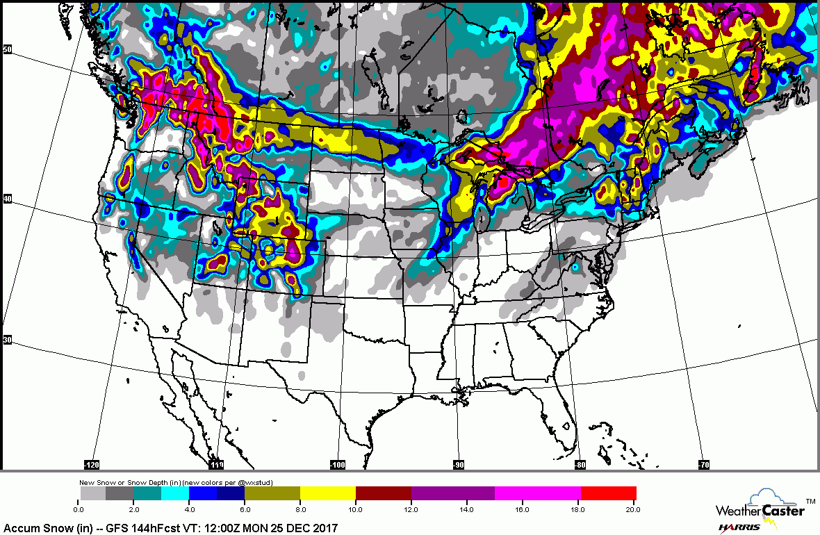
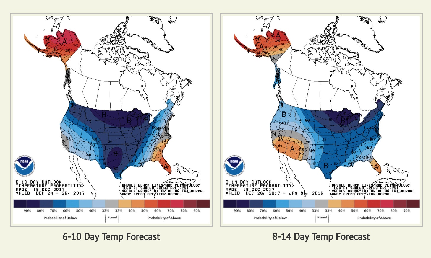
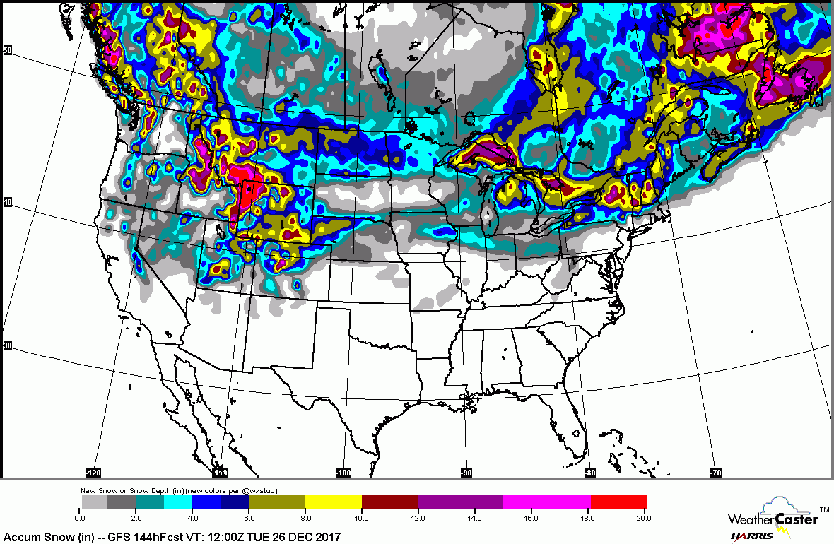
 Looks cold after Christmas... .LONG TERM /SUNDAY NIGHT THROUGH THURSDAY/... Potential for some accumulating snow into Christmas Day... Most sources of model guidance continue to trend eastward with cyclogenesis off the New England coast Monday (Christmas) morning, with the 12Z ECMWF, GFS, CMC and GEFS mean all indicating a strengthening surface cyclone offshore southeast of Maine by early Monday afternoon. An upper level trough axis is forecast to move through our region during the first half of Christmas Day, with an inverted surface trough extending westward from the main cyclone into southern New England and southeast New York. These features would likely result in at least a light snow accumulation across much of the area, which would impact holiday travel. We will continue to closely monitor model trends over the next few days, since a westward shift in this potentially developing cyclone would result in greater snowfall. Temperatures will gradually become much colder through much of next week, with all areas experiencing high temps below freezing by Tuesday. A weak upper level disturbance and a surface cold front passage will result in isolated to scattered snow showers Tuesday into Tuesday night. Temperatures will cool even further in wake of this system for Wednesday. 850 mb temperature anomalies of -1 to -2 STDEV will be common, with an even colder intrusion of arctic air possible Thursday courtesy of strong 1040+ mb high pressure building east into southern Ontario/Quebec. Depending on eventual wind speeds later in the week, wind chill values could approach advisory levels over the higher terrain.
"You just need to go at that shit wide open, hang on, and own it." —Camp
|
«
Return to Weather Archive
|
1 view|%1 views

