Spring Weather 2017
12345
12345
|
I'm sure good times will be had..
"Peace and Love"
|
|
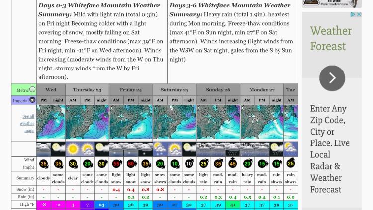
Looking dismal around here for the next week
mix of snow/rain and no sun 
|
|
Just gross..Spring in the NE sucks...
"Peace and Love"
|
|
Mud season is bad enough, worse when you have 2 goofy labs that don't clean up after themselves
|
|
Jason, what are you seeing for the northern Cascades? This mornings forecasts are showing Baker could get hammered. Might be time to make the longer drive up there.
One of my forecast sources is showing as much as 4' through Saturday, with a different forecast source showing QPF of 4+ inches, which would support the snowfall forecast.....
We REALLY need a proper roll eyes emoji!!
|
|
Here's my take...
The GFS is not that verbose with the qpf..Maybe 1-1.5 inches The NAM has close to 2"..That being said Baker has a way of getting stupid amounts of snow..I love to follow their season snowfall.. When the 12z data comes out I will take another look.. Also Baker isn't a big mountain until you go out side the gates...
"Peace and Love"
|
|
In reply to this post by tjf1967
2 down 4 to go out of the next ten.
|
|
I didn't say it wasn't gonna flurry...Does rain negate the snow
 
"Peace and Love"
|
|
In reply to this post by JasonWx
Thanks Jason.
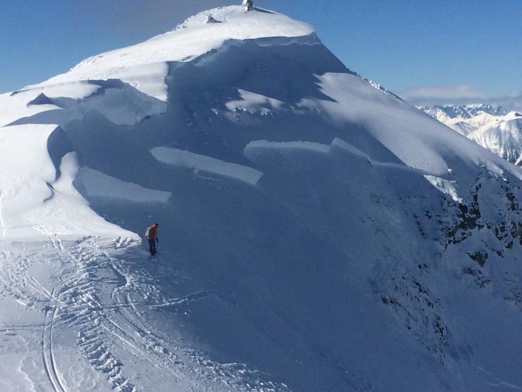
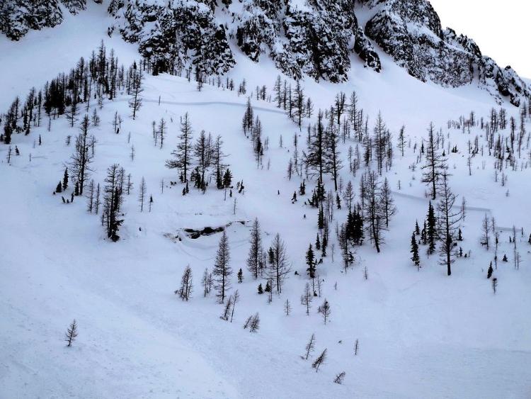
We may not need big. My brother is so out of shape it's going to be a 'relaxed pace' in any appreciable powder we find. Plus, while it may be small, Baker seems like it has lots of fun areas to explore. If we don't do backcountry we can try to put that money to private lessons, get someone to show us the goods. I may be spooked on the northern Cascades backcountry. Seems up that far and into British Columbia they have some PWL issues creating a Low Probability/High Consequence avy situation. Ruby, about 50 miles as the crow flies from Baker, pulled out BIG on Sunday.  A natural cornice release triggered that after warmth and rain on Saturday. Also lots of reports of wet slab activity at and below treeline. The Cedar Creek Drainage, just a bit south, had this one earlier in the month, which buried the guide, who was rescued by his clients. 
We REALLY need a proper roll eyes emoji!!
|
|
Baker forecasts thru Fri PM:
NOAA - 27 to 45 inches, with more on Saturday. Weather.com - 26 to 41, with more on Sat. OpenSnow - 24 to 40, more Sat. Mountain-Forecast showing 36, with more on Sat. Winter Science showing 3 inches QPF thru Fri pm. Can they all be wrong?
We REALLY need a proper roll eyes emoji!!
|
|
no they can't
but Larry Schick on Open Snow isn't going off on the forecast.. Also the new NAM isn't going off with the QPF 3-4ft might be more trouble then it's worth...
"Peace and Love"
|

We REALLY need a proper roll eyes emoji!!
|
|
avi etc...
snow is good
"Peace and Love"
|
|
Shutup and go ski already! You him and haw like a constipated pregnant lady!
I ride with Crazy Horse!
|
very true.. need to find a job that I don't work 6 days a week..
"Peace and Love"
|
|
This post was updated on .
In reply to this post by ScottyJack
Who? Me? Jason? Both?
I'm just trying to figure out WHERE to ski. Getting on a plane in 54 hours....and I may not know until I land and get in the car! It is worth hemming and hawing over the avi dangers in the northern Cascades right now. Did you LOOK at that picture from Ruby, from a Moderate rated day? A 3.5 , 400 yards wide, ran for 1,400', up to 25' crown, massively destructive. If we go to Baker and if they get several feet I'm will to stick to the relative safety of the in-bounds rather than temp a potentially squirrely snowpack in the backcountry.
We REALLY need a proper roll eyes emoji!!
|
  That's at 4800. The lows don't seem to drop below freezing, so the corn won't be a'cookin......yet.
We REALLY need a proper roll eyes emoji!!
|
|
JTG..I have been looking at NWS's MT Baker, Mt Rainier forecasts..There seems to be a major discrepancy with there discussion and point forecast...Also the NAM and GFS's QPF do not support those massive amounts..
Both forecasts show up to 80"..While the specific Mt forecast discussion is for around a 12" or so...A bit more for Baker.. http://www.wrh.noaa.gov/total_forecast/getprod.php?prod=XXXRECSEW&wfo=SEW
"Peace and Love"
|
|
This post was updated on .
Thanks for the info Jason.
I like what I'm seeing. Even the Rainier forecast you posted, with 5-12 Thurs evening thru Friday evening, not counting the moderate accumulations expected overnight Friday, and the additional accumulations expected Saturday am. I don't need all those forecasts I was seeing to be right, I just need them to not be entirely wrong. If Rainier sees 12+ through Sat am and Baker sees more than that....I'm good. Not much doubt, in my mind at least, and in everything but some of the OpenSnow forecast discussions, that the PNW is seeing the most snow out West through Sat am, and in the PNW Baker will come away with the most. So, whether I like what I'm seeing now or not, that's where I'm chasing. Hotel in Glacier is booked. Mt. Baker Mountain Guides is booked for a day in the backcountry on Sunday. Skiing the resort on Saturday. Baker is reporting 11" over the past 24 hours, which is on the low end of my previous forecasts for that period. That's on 1.3" of observed QPF for the period. While some of my forecasts have dropped off on the high end of the Thursday pm to Saturday am event, all are still generally calling for somewhere between 12 and 24 inches. The forecast QPF I'm seeing now for that period is 1.8", which would support 15" at the same ratio, which is right in the middle of the forecasts, and in line with your thoughts about Baker getting a little more than Rainier for that period. I'd be happy with that. Crystal reporting 1" in the past 24. Squaw reporting 7" overnight (12" since Tuesday). Snowbird 4". Arapaho Basin 0. On top of that, Baker has the most snow forecast now thru Sat am. This was a tricky chase but I think I ended up the right place. If they end up with 24 to 30 since Wednesday noon I think things will be nice. In speaking to the lead guide yesterday at MBMG he said the backcountry is looking good. He had guides in the field yesterday, and liked the forecast thru Sunday. He's very confident in the Baker snowpack, as we talked about the Ruby event and the PWL and cornice release that caused it. He isn't seeing the same risks around Baker, and if need be we can always keep it to lower angle, non-exposed stuff. Interestingly, OpenSnow generally doesn't seem to give a lot of PNW love. Schnick's forecasts lately are brief, his heart doesn't seem in it. Steve does the powder Chase forecast and he didn't even mention the PNW, although the the 11" at Baker trumps the 8" in the past 24 that he's jazzed about from Brian Head. He's focusing on chasing 4-8 in the Front Range overnight (with only 70% confidence), then touting 5-10 Friday into Saturday in the Sierra. Odd give that, even on the low end, you and I seem to agree that both Baker and Rainier/Crystal will do better....and not a mention.
We REALLY need a proper roll eyes emoji!!
|
|
I think Schick isn't going off on this because, there really isn't anything to get to excited about. Basically a week system.
But there are always surprises in the mountains.. Can't wait to read a report about Baker...Take some pics of the roadside snowbanks..I heard they are epic..
"Peace and Love"
|
«
Return to Weather Archive
|
1 view|%1 views

