Storm Speculation: 12/22/12

classic Classic list List threaded Threaded
65 messages Options
1234
Reply | Threaded
Open this post in threaded view
|

Re: Storm Speculation: 12/22/12

Darkside Shaman
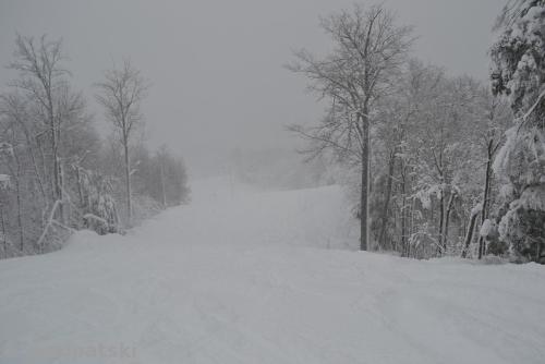
I left just before noon and the snow rain line was about half way up the lower mt., from there up was all snow, and there was about 8"-10" of heavy snow that skied much deeper
Where it was raining the snooooowww was sloooooooowww.
The sun is peeking out at Shaman HQ as I type.
Gotta go to know
Reply | Threaded
Open this post in threaded view
|

Re: Storm Speculation: 12/22/12

MadPatSki
In reply to this post by JasonWx
JasonWx wrote
it's my fault..me and my stinking pessimism..
Good here...all snow. Heavy!!! A quick 13 runs on apocalypse snow instead of going to work: TR at 11.
Ski Mad World
A blog of MadPat's World: A History of Skiing Geography
Reply | Threaded
Open this post in threaded view
|

Re: Storm Speculation: 12/22/12

freeheeln
In reply to this post by Darkside Shaman
cold behind it, should make for a great base! woods will be full on soon
Tele turns are optional not mandatory.
Reply | Threaded
Open this post in threaded view
|

Re: Storm Speculation: 12/22/12

MadPatSki
In reply to this post by MadPatSki
MadPatSki wrote
Good here...all snow. Heavy!!! A quick 13 runs on apocalypse snow instead of going to work: TR at 11.
Friday at Edelweiss QC : skiing on Apocalypse Snow
http://madpatski.wordpress.com/2012/12/22/edelweiss-qc-21-12-2012-skiing-apocalypse-snow/


After a few runs...
Ski Mad World
A blog of MadPat's World: A History of Skiing Geography
Reply | Threaded
Open this post in threaded view
|

Re: Storm Speculation: 12/22/12

evergreen
More good news !  After the Noreaster on Thursday we get two bluebird days and then this is in the works:

FRIDAY NIGHT INTO SATURDAY...AN EVEN MORE PROGRESSIVE LONGWAVE
TROUGH GETS CARVED OUT OVER THE CNTRL AND ERN US WITH ANOTHER STORM
IN THE ACTIVE SW FLOW IMPACTING THE FCST AREA.  THIS APPEARS TO BE
ANOTHER MILLER TYPE B...WITH A PRIMARY LOW OVER THE GREAT
LAKES...AND A SECONDARY WAVE FORMING NEAR THE DELMARVA.  ENOUGH COLD
AIR APPEARS TO BE IN PLACE FOR MORE SNOW CHANCES BASED ON THE LATEST
GFS/ECMWF/HPC GUIDANCE.
1234