Storm Speculation 2/6-2/7, 2020
1234


1234
|
This post was updated on .
Ok, with Winter Storm Warnings issued for the North Country this event warrants, finally, its own thread.
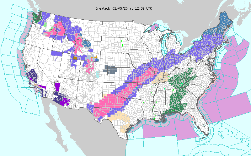
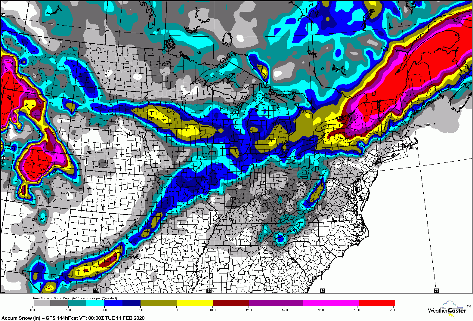
For the Northern Daks and NoVT the latest forecasts put this at a 10 to 16 inch event for the mountains, currently. There is some decent agreement in the models. How far north the warm front makes it will impact the outcomes, and with strong frontogenesis, weak stability, and a lot of available moisture, mesoscale banding could set up with the second wave of precipitation during the daylight hours Friday, resulting in some heavy snowfall rates. Snow starts overnight tonight into Thursday with cold air in place for everyone, and a quick burst of accumulating snow. 2-4 north with more in the mountains, and a couple inches down Gore way and even possibly the Cats. Then the warm nose moves in, changing precip to sleet, freezing rain, then rain for most, if not all. Fortunately, with a dry slot moving in with the warm front much of the sleet and freezing rain for Thurs afternoon and evening will be intermittent and light, especially far north. Then Thursday night into Friday the second wave comes through, temps drop, and snow could be heavy at times. When the mixed precipitation changes back to snow and where, exactly, the heavy snow sets up...who knows? All in all, for Northern mountains, this could be a good event. I wouldn’t bet on anything south of Gore, and I’m going to look into heading to Whiteface or Jay Peak Friday night.
We REALLY need a proper roll eyes emoji!!
|
|
Administrator
|
This post was updated on .
It's a monster:
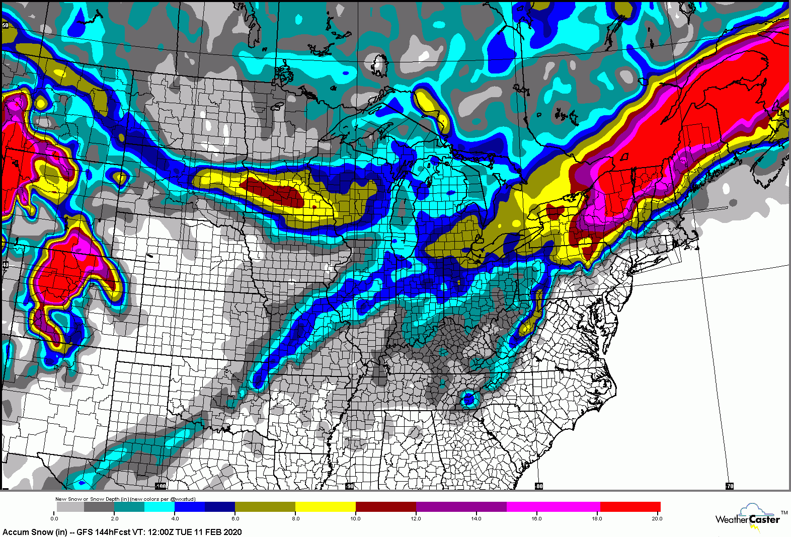
 and we are back to this: 
"You just need to go at that shit wide open, hang on, and own it." —Camp
|
|
In reply to this post by JTG4eva!
I figured the Northern boys would make out ok..
I'm heading to mighty Okemo on Friday..oh well
"Peace and Love"
|
Re: Storm Speculation 2/6-2/7, 2020
|
This looks good from gore northeast 12 inches on average combined both storms, sleet in the middle good snow for the woods
|
|
Hope it doesn’t shit the bed, just booked Saturday night in Placid.
We REALLY need a proper roll eyes emoji!!
|
Re: Storm Speculation 2/6-2/7, 2020
|
fingers crossed - pico this weekend, jay peak next weekend
|
|
Will be in Placid tomorrow afternoon into Monday - looks like it's gonna be a good weekend.
Skiing is not a sport, it is a way of life.
|
|
This marks the first weekend I am cleared by Dr to ski post herniated disc injury/epidural injection. Still hurts a little bit but have been able to resume normal activities like biking over the last 2 weeks. Going to give it a shot and take it easy.
Booked a room in Rutvegas with ability to cancel by Friday afternoon at no charge to hedge bets on how this unfolds. Either will head there or Gore depending on how totals stack up. In any case. I'm excited to be getting back out there this weekend. Just hope I fare OK. |
|
In reply to this post by ADmiKe
Storm skiing Friday could be really good. I’m sure I’ll see you around over the weekend.
We’ll also be up for Prez Day weekend. With unsettled weather and a few inches of snow each day next week the holiday weekend could be a good one!
We REALLY need a proper roll eyes emoji!!
|
Re: Storm Speculation 2/6-2/7, 2020
|
In reply to this post by ADmiKe
I loved my weekend at Whiteface lodge few weeks ago when we had the two snow storms. LP is such a great place.
|
The Whiteface Lodge is great. That’s where I snagged a room for this Saturday night. Beautiful, relaxing and really nice rooms (should be for the $$$)....and it also allows me to release my inner d-bag, with a nice breakfast, a soak in the hot tub, and maybe even a massage! 
We REALLY need a proper roll eyes emoji!!
|
Re: Storm Speculation 2/6-2/7, 2020
|
In reply to this post by JTG4eva!
My hope for Southern VT is the cold air on Friday really generates some light power going into Saturday.
Everything prior to that will be "base building" swag. |
|
Administrator
|
In reply to this post by Kleetus
Go easy Kleetus and good luck!
"You just need to go at that shit wide open, hang on, and own it." —Camp
|
|
In reply to this post by JTG4eva!
I misread at first - thought you were referring to your inner dirtbag and were just gonna car camp in the WF Lodge parking lot! And yeh, we'll be around town, and I'll be skiing with my dad and some other guys, so I'm sure I'll bump into you at some point.
Skiing is not a sport, it is a way of life.
|
Re: Storm Speculation 2/6-2/7, 2020
|
In reply to this post by Kleetus
Kleetus - Give me text/call if you're in Gore
|
Re: Storm Speculation 2/6-2/7, 2020
|
In reply to this post by JTG4eva!
great hotel, nothing beats a nice swim in the pool with temps around zero (MLK Weekend). They also tend to get more snow than Whiteface, always said if the face was just NW of LP instead of NE, they would pick up more snow....hotel is also around 2k feet.
|
|
In reply to this post by TheGreatAbyss
You got it! Soon as I know where I'm headed I'll let you know
|
|
Administrator
|
Yet a bit farther south:

"You just need to go at that shit wide open, hang on, and own it." —Camp
|
Re: Storm Speculation 2/6-2/7, 2020
|
In reply to this post by Kleetus
with a foot of new snow on the ground? that will take some serious control. good luck with that. |
«
Return to Weather Archive
|
1 view|%1 views


