Rebecca:

The system for Friday and Saturday is very complex. We will have a strong area of low pressure moving along the Appalachians. The track looks to take it over West Virginia and up over New York State. The cold front will be advancing across the Midwest and Great Lakes.
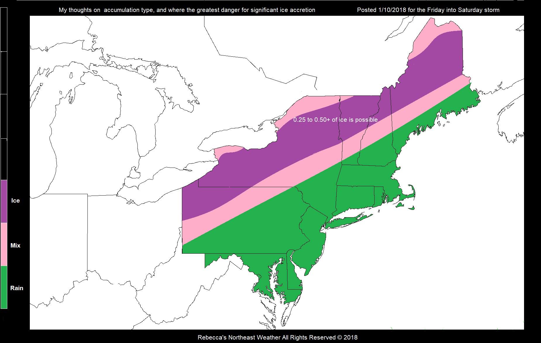
Things will start out as rain; but as the cold front gets closer, rain will change to a mix and then maybe some ice. Here is a map that shows what I think as far as precipitation type. But everything is still in flux. Those in the Pink area will see a mix of sleet, Ice and snow. Right now, I think the area in Purple has the greatest chance of seeing ice / sleet accretion of 0.25 to 0.50. Some of the models are showing ice amounts of over 1 inch; so higher amounts are possible. But those higher amounts will most likely be in the Ohio Valley into Canada. But a shift in track could make a huge difference.
Those in Western, Central, and Northern New York look to be at the most danger of crippling ice (0.50 or more) in spots. The areas in the pink and especially the areas in purple have the risk for power outages.
The combination of rain and melting snow. could lead to ice jam and some minor street flooding in poor drainage areas. where snow may be clogging the storm drains.
Everyone will change to snow on the backside. Those in New England and the Mid Atlantic look to have only a brief period of snow, while areas north and west will see higher accumulations. But if the colder air advances faster, we could end up with some fairly significant snowfall.
My confidence in what I'm saying isn't as high as I would like. But I want to get the word out so you can prepare. Lets hope I'm wrong....I sure do! Timing is up in the air so all of this is subject to change.
"You just need to go at that shit wide open, hang on, and own it." —Camp